First spaceborne measurement of vertical cloud motion
A Japanese radar has made the world’s first measurement of vertical cloud motion from space. Hitherto, data on vertical cloud motions could only be obtained by ground radar or airborne radar with limited observation areas. Thus, meteorologists are now equipped with a new tool. This will ultimately contribute to more precise weather predictions.
The measurement was made by the Cloud Profiling Radar on the satellite Earth Cloud Aerosol and Radiation Explorer (EarthCARE) which was developed jointly by the Japan Aerospace Exploration Agency (JAXA) and the National Institute of Information and Communications Technology (NICT) in collaboration with the European Space Agency (ESA).
A white dragon in space
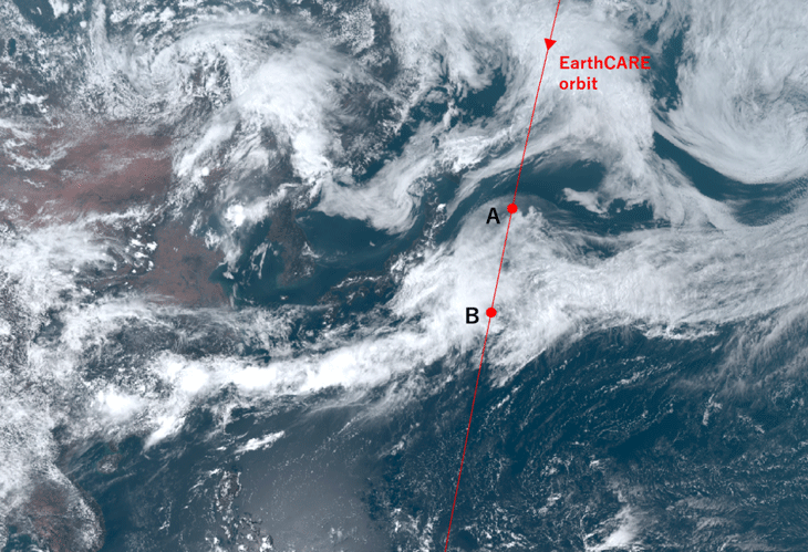
The Japanese name for the satellite is Hakuryu, meaning White Dragon. The name is inspired by the external appearance, since EarthCARE is white and has a solar array paddle that looks like a long tail. The satellite was launched May 29, 2024 (JST). After initial commissioning procedures, Hakuryu made its first observations on June 12 and 13. The onboard Cloud Profiling Radar observed the cloud area in a stationary front, called the Baiu front, over the ocean east of Japan. The observations constitute the world’s first measurement of vertical cloud motion from space.
The cloud and precipitation process, in which cloud droplets grow into rain, plays an important part in numerical weather prediction models that predict heavy rainfall and climate models that project future climates.
It is expected that the observations of various cloud regions made by Hakuryu will contribute to elucidating the mechanism by which cloud droplets grow into precipitation. In addition, the effect of clouds on the climate system is greatly influenced by factors such as cloud height, overlapping patterns, and cloud type. Therefore, using the spaceborne radar to measure vertical distributions of clouds, including their vertical motions on a global scale, will contribute to elucidating effects of clouds on the climate system.
Full operation in six months’ time
JAXA and NICT will continue to conduct the commissioning phase of the Cloud Profiling Radar for about six months and then move to the mission operation phase. Data will be made available on the JAXA and ESA websites.
ESA is currently conducting the initial functional verification of the ESA’s three sensors on the satellite. Eventually, it will become possible to produce images based on data from the Cloud Profiling Radar and the ESA sensors combined.
The text is inspired by the press release “First images from Cloud Profiling Radar (CPR) onboard Earth Cloud Aerosol and Radiation Explorer (EarthCARE) “Hakuryu” at the NICT website.
Featured image: Cloud imagery from the Himawari-9 meteorological satellite with the orbit of the EarthCARE satellite overlaid. Image credit: JAXA/Japan Meteorological Agency.
For more information please contact our contributor(s):

